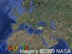
如果您只是想显示特定纬度经度的卫星地图图像(没有谷歌地图平移/缩放等),那么您应该查看谷歌静态地图。
您只需要构建一个 URL 字符串,然后为图像(以您喜欢的任何格式)发出 HTTP 请求(来自您的 java 实现)。你可以在 URL 中指定一大堆参数来获取你想要的卫星图像:

从网址:
http://maps.google.com/staticmap?center=40,26&zoom=1&size=150x112&maptype=satellite&key=ABQIAAAAgb5KEVTm54vkPcAkU9xOvBR30EG5jFWfUzfYJTWEkWk2p04CHxTGDNV791-cU95kOnweeZ0SsURYSA&format=jpg
如何从 URL 保存图像的示例:
import java.io.FileOutputStream;
import java.io.IOException;
import java.io.InputStream;
import java.io.OutputStream;
import java.net.URL;

public class SaveImageFromUrl {

    public static void main(String[] args) throws Exception {
        String imageUrl = "http://maps.google.com/staticmap?center=40,26&zoom=1&size=150x112&maptype=satellite&key=ABQIAAAAgb5KEVTm54vkPcAkU9xOvBR30EG5jFWfUzfYJTWEkWk2p04CHxTGDNV791-cU95kOnweeZ0SsURYSA&format=jpg";
        String destinationFile = "image.jpg";

        saveImage(imageUrl, destinationFile);
    }

    public static void saveImage(String imageUrl, String destinationFile) throws IOException {
        URL url = new URL(imageUrl);
        InputStream is = url.openStream();
        OutputStream os = new FileOutputStream(destinationFile);

        byte[] b = new byte[2048];
        int length;

        while ((length = is.read(b)) != -1) {
            os.write(b, 0, length);
        }

        is.close();
        os.close();
    }

}
